Windy Saddle Park

December 19, 2017

Trail(s): Lookout Mountain Trail, Buffalo Bill Trail, Chimney Gulch Trail
Location: Windy Saddle Park
Fees: Free
Website: https://www.jeffco.us/1440/Windy-Saddle-Park
Distance: 4.5 miles

It has been a while since I have explored one of the local, nearby parks.  With dog sitting duties, I decided to take Roo to Windy Saddle Park.  She runs trails with her owner who is training for a marathon, so I suspect she was sorely disappointed to half to walk.  None the less, at least she got to get outside and sniff out small mammals that fortunately stayed hidden in the brisk morning weather.

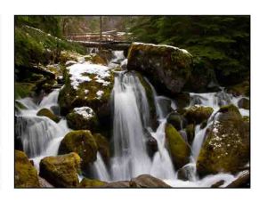
We began our hike on Lookout Mountain Trail which is located across the street from the main entrance of Windy Saddle Park on Colorow Road.  Windy Saddle Park is part of the Jeffco Open Space which manages a variety of parks surrounding Denver.

We strolled along a rocky path which undulated through a coniferous forest.  At the first trail junction, I took a right to climb up the Buffalo Bill Trail toward the Buffalo Bill Museum and grave.  I didn’t visit these tourist destinations that I doubt were dog friendly, but instead returned to the trail intersection where I went the other way and descended further down Lookout Mountain Trail.

The trail offered a nice view of the snow capped mountains to the west before it ended at a parking lot on the Peak-to-Peak Scenic Byway.  Upon crossing the street, I connected with Chimney Gulch Trail and continued descending toward the valley.  I was under a time constraint and worried that walking back up the trail would take me longer, so I didn’t make it to the end of the 1.4 trail, but hiked about half of it.

The view from the trail was of the City of Golden which wasn’t very exciting to me anyway, so I didn’t feel like I was missing much, especially given the dormant plant life during the winter.  It was a nice hike and good exercise, and of course always great to enjoy nature.  ETB

WANT TO VACATION SOONER?  IF SO, THIS VACATION CLUB IS FOR YOU!

Get the gist here: http://www.ratpacknation.net/pages/can-i-do-it

Want more details, click here:http://www.ratpacknation.net/pages/featured

To browse experiences or to sign up, click here:http://www.bethbankhead.dreamtrips.com

For notecards, key chains, or photographs, visit Notable Notecards or Niche Notecards on Etsy. A portion of the sales are donated to charity and a travel story is associated with each one.


Hiking Through Boulder Valley Ranch

November 9, 2017

Trail(s): Degge Trail to Hidden Valley Trail to Mesa Reservoir to Eagle Trail to Sage Trail to Cobalt Trail to Hidden Valley to Degge
Location: Boulder Valley Ranch
Fees: Free
Website: https://bouldercolorado.gov/osmp/boulder-valley-ranch-trailhead
Distance: 5.6 miles

On Thursdays, I aim for local hikes.  Today I picked one a mile north of Boulder at Boulder Valley Ranch.  We started at the Foothills Trailhead which actually shows up on Google Maps.

From the parking area, we walked up the road just briefly to find Degge Trailhead on the right hand side.  It had snowed on Tuesday (in Denver just a trace), but apparently in Boulder enough to melt and create a mud pit.  Within minutes, mud was caked to our trail shoes as we passed through a prairie dog colony.

After 0.4 miles on Degge Trail, we turned right onto Hidden Valley and wandered through the field toward a shooting range where we could hear one or two people practicing.  The trail offered a lovely view of the foothills behind us lightly dusted in snow.

After a mile in heavily weighted shoes, we reached Mesa Reservoir, where we followed the raised trail named for the body of water around its east side.  The reservoir was somewhat dry, but seemed like a nice habitat for birds.

From the reservoir, we left the “hiking only trails”, and joined the multi-use trails.  With a right turn on Eagle Trail, we descended a slick hill to a much wider, sun-dried path.  We followed Eagle Trail for 1.4 miles past another pond.  The tranquil water reflected images on its glass-like surface.

Soon we reached Sage Trail where we looped back toward our starting point.  More prairie dogs sure tempted Utani.  She was definitely leash bound today.  We followed Sage Trail for 1.1 miles past a field of cattails and a herd of cattle before we reached another parking area.

We passed through the parking area and joined Cobalt Trail, another “hiker only” option.  The trail passed beneath a 1930’s smelter before it reconnected with Hidden Valley Trail and Degge Trail.  Fortunately I had printed a map of the trail system, and Tanya took the time to navigate, as otherwise, I’m not sure how many small circles we would have made.

While the beginning of the hike didn’t seem terribly promising as we trudged through mud, as we carried on light snow and the sunny weather provided for a picturesque local excursion.  After connecting all the dots on the map, we ended up hiking a 5.6 mile loop before we stopped for some coffee!  ETB

WANT TO VACATION SOONER?  IF SO, THIS VACATION CLUB IS FOR YOU!

Get the gist here: http://www.ratpacknation.net/pages/can-i-do-it

Want more details, click here:http://www.ratpacknation.net/pages/featured

To browse experiences or to sign up, click here:http://www.bethbankhead.dreamtrips.com

Shop small business Saturday, 11/25/17.

For notecards, key chains, or photographs, visit Notable Notecards or Niche Notecards on Etsy. A portion of the sales are donated to charity and a travel story is associated with each one.

Hike in Golden

November 2, 2017

Trail(s): North Table Loop, Tablerock Trail, Mesa Top Trail, Tilting Mesa Trail
Location: North Table Mountain
Fees: Free
Website: https://www.jeffco.us/1427/North-Table-Mountain-Park
Elevation:6,000-6,400 feet
Distance: 5.3 miles roundtrip

Today I drove to Golden to hike at North Table Mountain Park, part of Jeffco Open Space.  Cottonwood Canyon Trail on the Southeast side of the park was closed due to rattlesnake activity, so I started at the West Trailhead and stuck to the west and north sections of the park.

I began on an easy section of North Table Loop and headed north through dormant grasses as I passed housing developments and an industrial park to the left that didn’t provide a terribly exciting view in my opinion.  I basically followed the outer edge of the park on this trail and Tablerock Trail for 2.5 miles until I reached the east side of the park where I turned into its center on Mesa Top Trail.

Mesa Top Trail is aptly named as I gained 400 feet in half a mile as I climbed to the top of the mesa.  To my surprise, I came across a small water fall at the top and then carried on along the flat dirt surface to small pond, a paradise for the ducks which floated across the tranquil water beneath the now sunny sky.

I began the hike beneath overcast skies and in cooler than expected temperatures, so I welcomed the sun as I crossed the grasslands on Tilting Mesa Trail before I began my descent down a steep section of North Table Loop that mostly followed a gravel or asphalt road (also somewhat unappealing).

While I enjoyed the middle section of the park, the outer section was not deep enough into nature for me.  Regardless, it was good to get out, explore, and get a five-mile hike under my belt (more fun than going to the gym).  ETB

WANT TO VACATION SOONER?  IF SO, THIS VACATION CLUB IS FOR YOU!

Get the gist here: http://www.ratpacknation.net/pages/can-i-do-it

Want more details, click here:http://www.ratpacknation.net/pages/featured

To browse experiences or to sign up, click here:http://www.bethbankhead.dreamtrips.com

50% OFF Sale on Notecards through 11/10/17.

For notecards, key chains, or photographs, visit Notable Notecards or Niche Notecards on Etsy. A portion of the sales are donated to charity and a travel story is associated with each one.

Visit Star K Ranch

October 21, 2017

Trail(s): Star K Ranch Loop and Sand Creek Greenway between Chambers and North Airport Blvd.
Location: Star K Ranch
Fees: Free
Website: https://www.auroragov.org/cms/One.aspx?portalId=1881221&pageId=5144852
Elevation: 5,280 feet
Distance: 3 miles roundtrip

I have a day care dog named Roo on Tuesdays now.  She is a Vizsla which is a dog breed from Hungary bred to work as a pointer.  Needless to say, she is energetic and goes on 18 mile trail runs with her owner.

I decided to take her to Star K Ranch, part of Aurora’s Open Space and home to Morrison Nature Center.  Since I had Roo with me, I didn’t visit the center, but I followed the west side of the loop trail to Sand Creek Greenway where I turned right and headed west.  We jogged the soft-surface, gravel trail to Chambers Road.  This short half mile led us past an industrial plant on the right and Sand Creek on the left.

At Chambers, we turned around and detoured off the main Sand Creek Trail and followed a single-track trail by the creek.  I found it more peaceful to be  closer to the tranquil water.  Soon the trail came to an end where we joined the Sand Creek Greenway again and followed it east to North Airport Blvd.

While the trail goes beneath both the roads we reached, running this segment both ways plus the loop at Star K Ranch added up to three miles, which is about my limit these days.  Poor Roo was probably sorely disappointed that her run was over as she was just getting warmed up.

It was nice to change up my three-mile run from the neighborhood to a trail along the grassy plain beneath the shade of cottonwoods.  And Roo enjoyed pointing at the rabbits that took cover in dormant bushes.  ETB

WANT TO VACATION SOONER?  IF SO, THIS VACATION CLUB IS FOR YOU!

Get the gist here: http://www.ratpacknation.net/pages/can-i-do-it

Want more details, click here:http://www.ratpacknation.net/pages/featured

To browse experiences or to sign up, click here:http://www.bethbankhead.dreamtrips.com

For notecards, key chains, or photographs, visit Notable Notecards or Niche Notecards on Etsy. A portion of the sales are donated to charity and a travel story is associated with each one.

Hiking the West Side of Mount Falcon Park

October 21, 2017

Trail(s):  Castle Trail to Meadow Trail to Old Ute Trail to Devil’s Elbow Trail to Old Ute Trail to Parmalee Trail
Location: Mount Falcon Park
Fees: Free
Website: http://jeffco.us/open-space/parks/mount-falcon-park/
Elevation: 6,000-7,600 feet
Distance: 4.9 miles roundtrip
Hours: Sunrise to Sunset daily

Another Saturday, another hike…or at least that is the goal!   Today Marissa, Ross, and I tackled a different section of Mount Falcon Park, this time from the west parking lot.

I failed to have a map with me, so we missed one segment on Tower Trail that I wanted to do, but with three dogs in tow, it was likely best, as getting tugged up and down anything steep would have been less fun.

We started out on Castle Trail and hiked to the ruins of John Brisben Walker’s castle which burned to the ground in 1918 after being struck by lightening.

Walker was a true Renaissance man.  He bought and sold the Cosmopolitan Magazine after increasing its circulation from 16,000 to 400,000 in six years; he built the longest COG railway in the world to the summit of Mount Morrison; he manufactured several models of automobiles and sponsored the first automobile race in the USA; and he invested in land including Mount Falcon and Red Rocks to which he built a road and trails, and promoted the venue as acoustically perfect for concerts.  These were  just a few of his endeavors.

After visiting the jagged, stone ruins, we moved on, following the undulating path through intermittent evergreen forest. The difference in the west side and east side of the park is pretty amazing.  The east side is much more desert like relative to the west side which is peppered with pine trees.

We were also lucky to find protection from the high winds on this brisk morning.  In fact, it felt much windier in Denver than at the park.  We went from donning gloves and a wool hat to stopping for water by the time we reached the sun drenched Parmalee Trail.  The cool temperatures, however, kept the wildlife out longer, and we spotted a few deer!

The dogs loved the hike as well, especially when they stopped for pats from all the volunteers working on the trail today.  After our short, two-hour hike, we stopped for lunch at the “World Famous” Sit-N-Bull.  It was 12:30pm, but only breakfast was being served.  OK, that was fine…I love breakfast, though I think having a beer with eggs was a first for us.  ETB

WANT TO VACATION SOONER?  IF SO, THIS VACATION CLUB IS FOR YOU!

Get the gist here: http://www.ratpacknation.net/pages/can-i-do-it

Want more details, click here:http://www.ratpacknation.net/pages/featured

To browse experiences or to sign up, click here:http://www.bethbankhead.dreamtrips.com

For notecards, key chains, or photographs, visit Notable Notecards or Niche Notecards on Etsy. A portion of the sales are donated to charity and a travel story is associated with each one.


Green Mountain Loop In Boulder

October 19, 2017

Trail(s): Green Mountain Loop
Location: Chautauqua Park
Fees: Free depending on parking area chosen
Website: https://bouldercolorado.gov/parks-rec/chautauqua-park
Elevation: 5,200-8,150 feet
Distance: 6.0 miles roundtrip
Hours: 5am to 11pm

It was a small miracle, but Tanya and I were finally able to connect on Thursday for a hike, only five months after our last one together! Clearly our schedules did not mesh, and when we first planned to hike Green Mountain Loop in Chautauqua Park in Boulder we expected we’d have some time restrictions, so we opted for a short and nearby hike.

Who knew a six mile hike beginning at 5,277 feet would take a full three hours! I failed to read the description before I picked the trail, and it was sort of hard for a local trek. After completion, we found it was rated difficult and the clockwise direction we took made it harder!

Fortunately, we snapped a photo of the sign at the trailhead as the Green Mountain Loop included a combination of several trails. We started on the 6th St. Connector Trail which took us to Meadow Trail. Meadow Trail, appropriately named, led us through a golden grassy meadow occasionally dotted with bushes turning brilliant red with the fall weather upon us.

Soon we reached Amphitheater, Saddle Rock, and EM Greenman Trails which all connected together to reach Green Mountain Summit at 8,144 feet. In Colorado, that’s not even close to high, but gaining 2,867 feet in three miles is steep. I had stopped to snap a photo of the natural rock stairs we were climbing as they looked lovely surrounded by fall foliage. Little did I know, I’d have countless opportunities for this. We climbed stairs almost the whole way up! Based on a 12 foot ceiling, that’s 239 stories over uneven steps.

At the top, we were blessed with views of snow capped mountains to the West and the City of Boulder to the East. We snacked on our lunch as a chipmunk tried doing the same, before we headed back down the mountain on Ranger Trail and through Gregory Canyon before we reached Baseline Trail to end the loop near our car. After initially climbing down a few stairs, we descended along a smooth dirt path peppered in pine needles. This way was much easier! Overall it was a lovely hike and we couldn’t have asked for a nicer day. ETB

WANT TO VACATION SOONER?  IF SO, THIS VACATION CLUB IS FOR YOU!

Get the gist here: http://www.ratpacknation.net/pages/can-i-do-it

Want more details, click here:http://www.ratpacknation.net/pages/featured

To browse experiences or to sign up, click here:http://www.bethbankhead.dreamtrips.com

For notecards, key chains, or photographs, visit Notable Notecards or Niche Notecards on Etsy. A portion of the sales are donated to charity and a travel story is associated with each one.

Hike in Mount Falcon Park

October 7, 2017

Trail(s): Turkey Trot Trail to Castle Trail to Walkers Dream and back down Castle Trail
Location: Mount Falcon State Park
Fees: Free
Website: http://jeffco.us/open-space/parks/mount-falcon-park/
Elevation: 6,000-7,600 feet
Distance: 6.2 miles roundtrip
Hours: Sunrise to Sunset daily

It has already been snowing in the mountains, and a big snow storm is coming to Denver on Monday, so today we made the most of the sunny, seventy degree day by heading to Jeffco Open Space.

Jefferson County does a great job with their parks.  There are a wide variety, and they are free.  I should really hike these trails more often due to the close proximity to Denver, but I guess sometimes I like to go far enough into the mountains that my view from the summit doesn’t include a city.

Regardless, today Mike, Paula, Ross and I opted for a short hike to the Summer White House Ruins, a “summer white house” dreamed up by John Brisben Walker for then president Woodrow Wilson.

Walker was a true Renaissance man.  He bought and sold the Cosmopolitan Magazine after increasing its circulation from 16,000 to 400,000 in six years; he built the longest COG railway in the world to the summit of Mount Morrison; he manufactured several models of automobiles and sponsored the first automobile race in the USA; and he invested in land including Mount Falcon and Red Rocks to which he built a road and trails, and promoted the venue as acoustically perfect for concerts.  These were  just a few of his endeavors.

I doubt if building a house on top of a summit for the president seemed like much of an endeavor!  Unfortunately, the house never made it past the foundation due to lack of funds (despite all Colorado school children investing a dime), and the coming of WWI.  Sadly, Walker died penniless at the age of 83.

Our hike began at the East parking lot of the park.  We didn’t begin until 1pm, so I was leery about finding a parking space on this glorious day.  Lucky for us, many people were finishing up their visit to the park, so we found some empty spaces on the nearby street.

From the parking lot, we followed Castle Trail just briefly until we reached Turkey Trot Trail which branches off to the right.  The Turkey Trot Trail is a mountain bike free zone, so the first 1.7 miles of the hike were rather peaceful as we only shared the trail with fellow hikers and one rattlesnake.  Fortunately the snake seemed very happy quietly resting in the shade.

The dry, dusty trail mostly led us uphill beneath the sun, though occasionally we found the shade of a conifer.  Soon it connected back to Castle Trail where we turned right and continued uphill for another 1.2 miles where we connected to Walkers Dream Trail just past the shelter.

After 0.4 more miles of climbing, we finally reached the ruins which was a small wall with a plaque!  We ascended 1,600 feet for that?!? The end result was a little disappointing, but the exercise, company, and nice weather made up for it.  Also, the view to the west of snow-capped mountains was lovely.

Our return hike took us back to Castle Trail which we stayed on all the way to the parking lot.  We came across several mountain bikers, though I have to say they were quite courteous.  Most of them yielded for us!  They claimed they needed an excuse to rest, but if I were on a mountain bike going uphill, if I stopped that would be the end of that.  Hikers do have the right away, but generally it is easier for us to move over.  Anyway, the descent to the parking lot was easy and quick.

The hike was very nice, and while I usually try to do different hikes, I did a “repeater”. This was the first hike I completed after moving to Denver when I had no familiarity with the area, so it was kind of fun to redo, though I was trying to change the final destination to the Walker Home Ruins, not the Summer White House (had I known which were which).

I think I will go back to the park and start from the West parking lot to explore some other trails in the park which are closer to the Walker Home Ruins!  Maybe Mike, Paula and Ross will do that with me and then come over for some more Settlers of Catan…what a fun way to end the evening!  ETB

WANT TO VACATION SOONER?  IF SO, THIS VACATION CLUB IS FOR YOU!

Get the gist here: http://www.ratpacknation.net/pages/can-i-do-it

Want more details, click here:http://www.ratpacknation.net/pages/featured

To browse experiences or to sign up, click here:http://www.bethbankhead.dreamtrips.com

For notecards, key chains, or photographs, visit Notable Notecards or Niche Notecards on Etsy. A portion of the sales are donated to charity and a travel story is associated with each one.

Go to a Wonderbound Performance

April 30, 2017

I wasn’t exactly sure what I’d be getting into when I accepted an invitation to Wonderbound from my friend Tanya.  The performance was a pleasant and interesting experience.

Wonderbound is a dance group that performs contemporary dance along with live music while sticking to three fundamental values – community, collaboration, and creation.

This month’s performance took place at DU with the hip-hop band Flobots, from Denver.  The lead singers sang and rapped while dancers moved around the stage in modern ballet style.  For two songs, the group even included the audience which was very entertaining.  The collaboration explored the “struggles between personal identity, community, individual freedom and collective power.”

I didn’t really focus on the deeper meaning, but simply enjoyed the music, dance and atmosphere.  The performance was quite good.  I’d recommend seeing them at least once.  If tickets aren’t in the budget, go see them at an open door rehearsal.  https://wonderbound.com/ ETB

WANT TO VACATION SOONER?  IF SO, THIS VACATION CLUB IS FOR YOU!

Get the gist here: http://www.ratpacknation.net/pages/can-i-do-it

Want more details, click here:http://www.ratpacknation.net/pages/featured

To browse experiences or to sign up, click here:http://www.bethbankhead.dreamtrips.com

For notecards, key chains, or photographs, visit Notable Notecards or Niche Notecards on Etsy. A portion of the sales are donated to charity and a travel story is associated with each one.

Take a Tour of LASP at CU Boulder

April 28, 2017

I’m currently taking an enrichment class at DU called, Robotics in the Solar System. It is a fascinating class where we are learning about different space missions to Mars, Pluto, Mercury, and Jupiter. Our instructor, Paul Hemenway, worked on the Hubble telescope for 18 years.

As part of the class, we do a field trip. As such, we visited LASP, Laboratory of Atmospheric and Space Physics at the University of Colorado in Boulder on Friday. Public tours are available, though they prefer groups of at least eight. Tom Mason, the Director of Communications and Outreach, is who provides the tour. http://lasp.colorado.edu/home/personnel/tom.mason/

LASP is a full-cycle space research institute and a leader in atmospheric and space research. The institute employs 397 professionals and 150 students. It raises on average $70 million in research money and grants from NASA and other organizations for CU Boulder.

LASP has a mission operations and data systems group that trains and certifies undergraduates to perform mission operations. Currently, LASP operates five different space missions for NASA including AIM, Kepler, SORCE, QuikSCAT, and MinXSS CubaSat. Mission operators monitor and control the spacecraft and their instruments. An example, might be that a camera is turned off to save power, or the solar panel is tilted toward the sun, or the space craft is rotated slightly to ensure the correct orbit around a planet. These missions take years just for the spacecraft to reach its destination.

In addition to operating space missions, LASP designs and builds instruments such as spectrographs that are used on the spacecraft. Currently, LASP operates over 125 different instruments on spacecraft missions. We got to see life size models as well as scaled down versions of some the spacecraft in which they have been involved. In addition, we saw some of their engineering and clean rooms.

Anyone interested in space would enjoy this tour! ETB

For notecards, key chains, or photographs, visit Notable Notecards or Niche Notecards on Etsy. A portion of the sales are donated to charity and a travel story is associated with each one.

Enjoy a Wind Symphony in Denver

April 8, 2017

Saturday some friends and I attended a Colorado Wind Ensemble Concert.  The CWE collaborated with the Rocky Mountain Brassworks to present a unique show.  The two orchestras sat on separate sides.  Directed by their respective conductor, each played their own pieces, while they played the opening and closing piece together.  Each them both played Moorside Suite separately, so the audience could hear the difference.  I really enjoyed listening to the variance.  We were able to sit very close to the front, so we could see the musicians in detail.

symphony

I’ve lived in Colorado just over five years now, I have not heard of the ensemble or the band.  The CWE is in its 35th season!  The ensemble maintains an artistic residency at Metropolitan State University of Denver, and plays a six-concert season at a variety of venues around Denver.  Saturday night’s symphony was performed at the King Center on the Auraria campus.  The Venue was quite nice with good acoustics.  The CWE plays one more symphony this year called Worlds Away on May 20, 2017.  The tickets range from $5-$15. 

The Rocky Mountain Brassworks was formed in 1974 as the Colorado Brass Band and only played a few times a year.  It became the Rocky Mountain Brassworks in 1978.  The band uses instruments from the saxhorn family which produce a mellow tone.  Different instruments are used or excluded.  The tenor horn replaces the french horn and trumpets are excluded.  The Rocky Mountain Brassworks has two upcoming concerts, May the 4th Be With You featuring the music of “Star Wars” on May 4, 2017 and the 6th Rocky Mountain Brass Band Festival on May 20, 2017.  Tickets range from $5-$15 as well.  http://www.rockymountainbrassworks.org

I tend prefer the wind symphony over the regular symphony, so I was excited to find this concert on Saturday night.  It is also a nice way to enjoy the symphony at a reasonable price.  ETB

Things to do in Denver